Workshop on Equivariance and Data Augmentation recordings posted
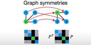
Exploiting symmetry in structured data is a powerful way to improve learning and generalization ability of AI systems, and extract more information, in applications from vision and NLP to robotics. …